urban
design
+ arch
We view the public realm as
the canvas to express and strengthen a community’s values, cultures and connections.


Urban design and architecture are at the center of Framework’s approach to shaping and supporting cities; we focus on building strategies that reflect what people truly care about for their community.
Street Design
Public Realm Plans
Architecture
Master Planning
Public Space Design
Trails
Alleys
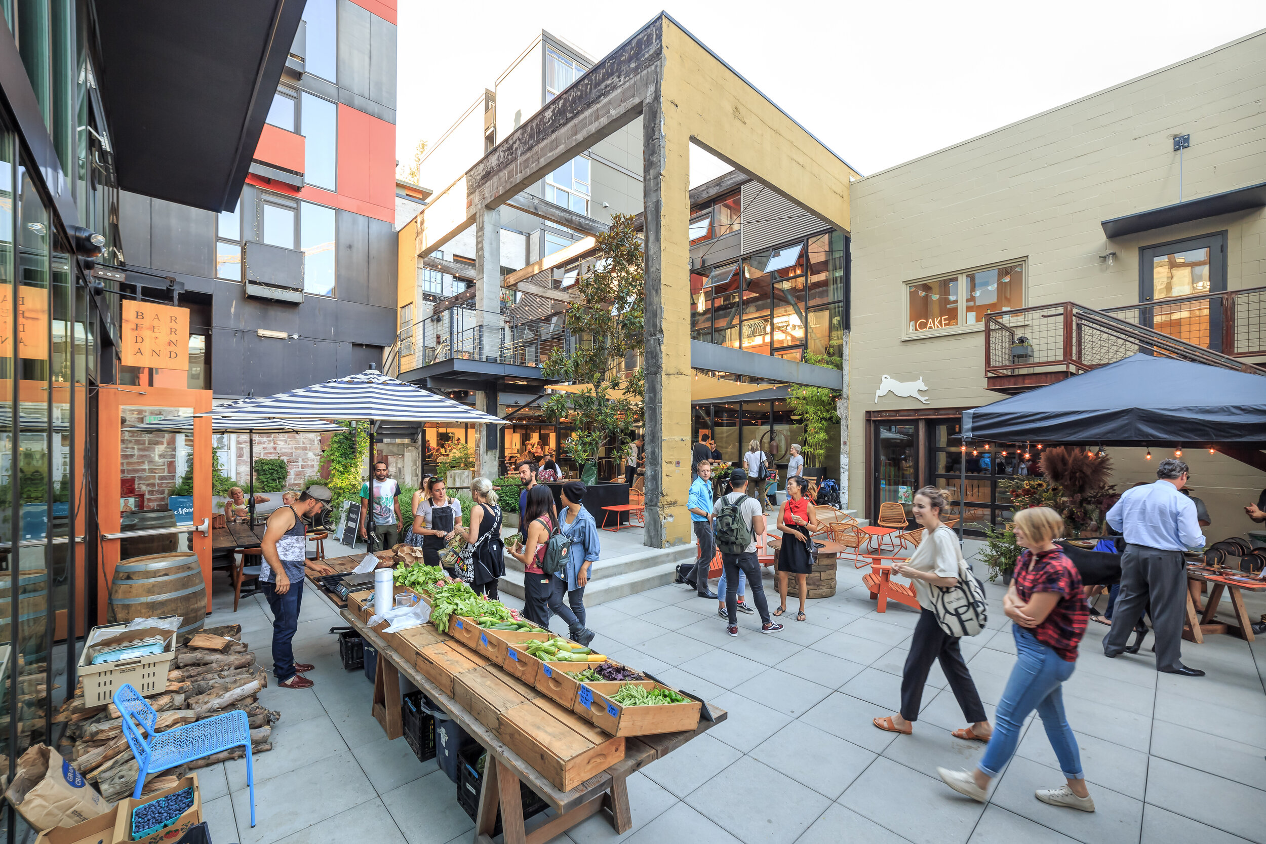
terry avenue street master plan | seattle, wa
Terry Avenue North Street Master Plan is one of the Seattle’s first street concept plans, and a test case for maximizing pedestrian use of the right-of-way. Now partially built out with Amazon.com’s headquarters, new biotech facilities, and a new streetcar, the Terry Avenue Master Plan is used as a national model for conceptual thinking and better street design.
MICA | mercer island, wa
The Mercer Island Center for the Arts (MICA) was designed as a new home for theater, music, dance, and the visual arts to the community of Mercer Island, WA. Framework was the project and architectural lead for the project. The program for this new 38,000 square foot building included a 300-seat main stage theater, a black-box venue, and a multi-use recital studio.
cornish college of the arts | seattle, wa
Framework assisted Cornish College of the Arts with a wide variety of facilities improvements and master planning issues. We helped the College incorporate accessibility improvements to its campus and modify its learning spaces to accommodate new programs and pedagogical approaches. We worked with facilities staff to analyze building conditions and assess the suitability of existing spaces for Cornish’s evolving multi-disciplinary curriculum.
seattle center theatre district + commons | seattle, wa
Framework founder Lesley Bain worked with landscape architects GGN on the Theatre District, and the subsequent Theater Commons. Theater Commons transformed a 1.6 acre parking lot into a green, inviting entry to Seattle Center. Theater Commons links the space between the Seattle Repertory Theatre and the Cornish Playhouse.
broad street green | seattle, wa
Broad Street Green is the defining line that marks the eastern edge of Seattle Center. Our design created a sweeping, generous hardscape edge that has transformed seasonally with 5,000 tulips that match the fiery red of Alexander Lieberman’s Olympic Iliad sculpture.
seattle center skatepark | seattle, wa
When the Bill & Melinda Gates Foundation began construction, the beloved skatepark lost its home. After a challenging process, SeaSk8 found a new location at a key a key entry to Seattle Center. Skatable street elements defined the park, along with skatable public art, including the only known skateable glass. Artist Perri Lynch Howard used enlarged photographs of used skateboards as a laminate between panes of glass.
belroy apartments | seattle, wa
This project designated the original building as a historic landmark, and created an ensemble of old and new residential units within a gardened setting. The project sought to reconcile the new with the old, and fully integrate landscape with the buildings. A significant issue in the entitlement of the project was the approval of a rezone to increase the height of a portion of a new building. The rezone allowed a low wing, matching the height of the original building, and a higher bar along the north edge of the site.
kendall square framework plan competition
The City of Cambridge launched a national design competition to create a unique and forward-looking neighborhood. Framework’s team was one of four design teams selected to create a design concept. Our submission, The Public Space Center, marries the unique resources of MIT to the real-world neighborhood of Kendall Square, testing and evaluating innovation in public space.
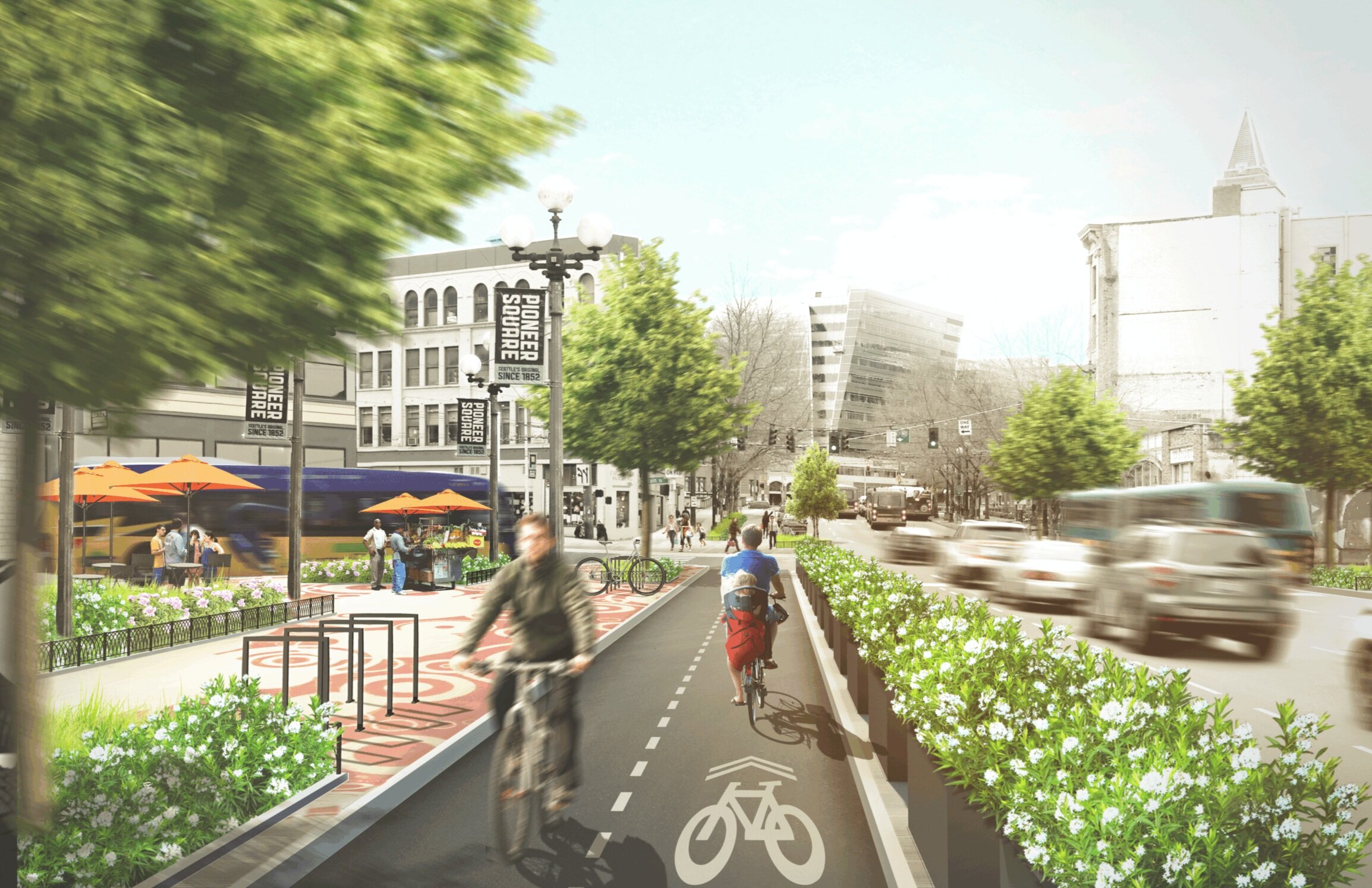
LID I-5 | seattle, wa
Seattle began a serious study to explore the feasibility of building a new lid, or lids, across Interstate 5 in the core of Seattle's downtown. Framework led urban design for the WSP team, looking at the complicated context along the roughly 1-mile segment in terms of topography, current uses, zoning, connections and demography. The study is intended to inform public sector decisions long into the future.